An international role model
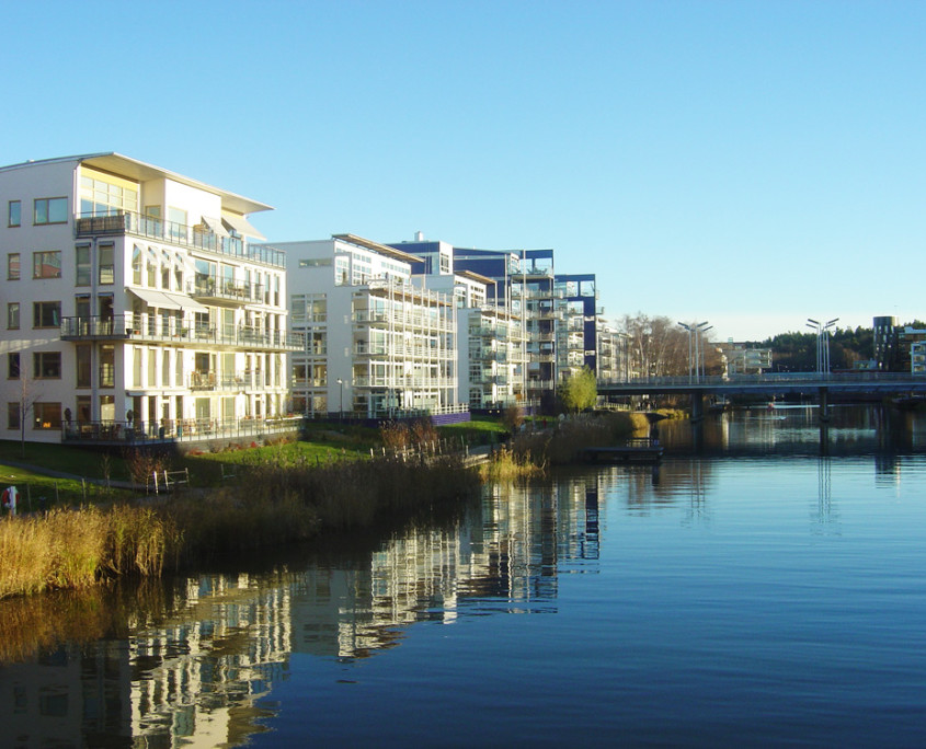
The water has given its name to the new city district – HammarbySjö – the townaround the lake where planning work beganback in the 1980s. It was here that a unique opportunity to expand Stockholm’s inner city was envisaged, by converting an old industrial and harbour area into amodern city district. The focus throughout the planning work was on water and eco-friendly solutions. HammarbySjöstad now welcomes 13,000 visitors a year from all over the world.
HammarbySjöstad is Stockholm’s biggest urban development project for many years.The city district will offer a natural expansion of Stockholm’s inner city – a factor that hasinfluenced the structure, infrastructure, layoutand construction design.
The expansion required extensive development of the infrastructure, with traffic barriersremoved and the old industrial and terminalareas phased out, concentrated or given anew purpose. Stockholm and Nacka municipalities have agreed on the ways in whichthe areas on either side of the shared municipalboundary could interact and develop.
HammarbySjöstad adds a new “growth ring” to Stockholm’s urban growth – a modern,semi-open block-based city, a combinationof a closed, traditional inner city withmore modernistic and open planning types.The inner city street dimensions, block sizes, building heights, density and functionalitymix are integrated with a new openness,waterfront views, parks and sunlight.
Limited building depths, recessed penthouse flats, maisonettes, large balconies andterraces, big windows, flat roofs and light colouredrendering on water-facing facadesembody different applications of a modernisticarchitecture programme, as does the focuson sustainable materials, such as glass,wood, steel and stone.
Traffic and services are concentratedalong a three-kilometre avenue linking HammarbySjöstad together, from Mårtensdal toDanvikstull.Parks, quays and walkways have been laid out around HammarbySjö itself, whilethe water areas at the heart of the districtcomprise a concentrated visual park – thecity district’s blue eye.
Taller buildings, facing the water, have been built along both sides of the HammarbySeaway, in classic city centre style,and interact with large-scale quay facilitiesand expansive stretches of water.
The milieu at SicklaUdde and alongsideSicklaKanal is more intimate and smallerscale, with its natural beaches. Here, buildingsizes gradually fade towards the shorelineand then follows the contours of the landas it rises towards the avenues’ crown andSickla Park.
The housing in SicklaKaj has a more urbanstyle. Large-scale, multi-functional buildingslie along the avenue, while small-scale,detached front and back courtyard buildingslie between the quays and the Sjöstad parterre,the park promenade.
HammarbyGård has dense, urban milieus around a lens-shaped park area and a newlycreated pool.
Lugnet, on the shores of HammarbySjö,is home to a waterfront terrace, known asLugnetsTerrass, with jetty decking, pergolasand specially planted areas, adjacent to theavenue. Lugnet is also home to HammarbySjöstad’s most special feature building in theform of a latticed cube that is double theheight of those that surround it.
The Henriksdalshamnen harbour is amongthe last of the planned areas in HammarbySjöstad. Large numbers of quays are beingbuilt out into the water to create, amongother things, a harbour basin with space forrestaurants and small boats.
The plan is to route the heavily-traffickedVärmdöleden highway along a tunnel throughHenriksdalsberget, to extend the Tvärbananlight railway towards Slussen, and to extendthe avenue all the way up to a new servicecentre at Danvikstull.

